How Internet Bloggers May Have Located Secret ISIS Training Grounds
A group of online, crowdfunded bloggers claim that they have pinpointed the location of a terrorist training ground used by the Islamic State of Iraq and Syria (ISIS). By simply examining peripheral landmarks in pictures posted by the terrorists to social media accounts, the bloggers claim to have verified the locations of the pictures using free online satellite imagery programs.
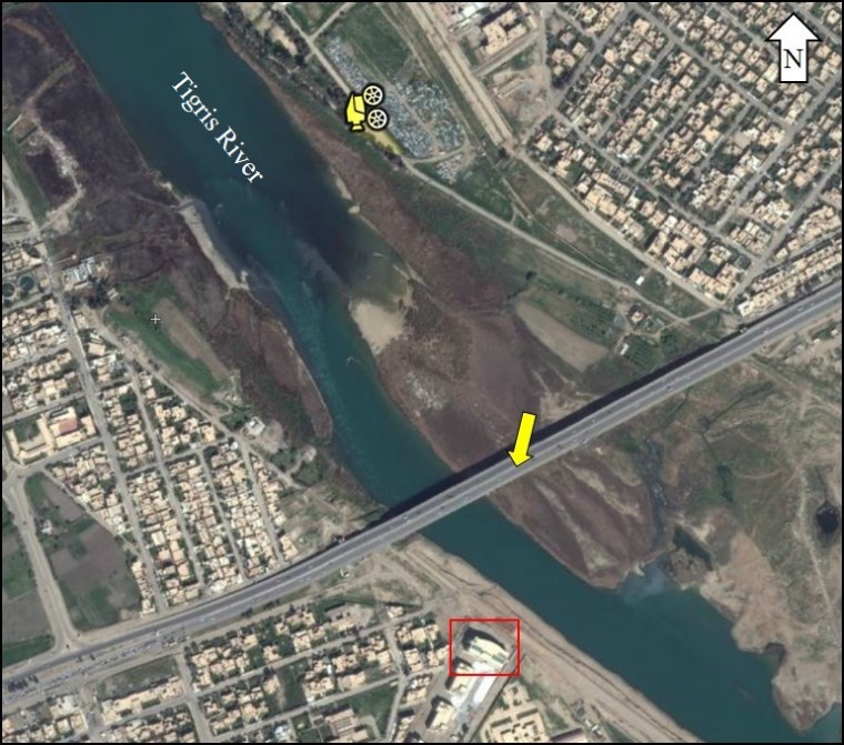
A team of journalists, researchers and bloggers contributing to the crowd-sponsored investigative blog Bellingcat.com, which researches conflict zones and other "issues being ignored" by the U.S. government, claim that they found that the general area of the training ground is near the west bank of the Tigres River in the north side of the city of Mosul.
The website received over $85,000 in funding donations through its participation with the Kickstarter.com funding website. The site was started by Elliot Higgins, who first came to fame for proving that Syria was using chemical weapons by using online videos and images. Higgins said he started the project to show that everyday people are capable of uncovering secrets of the state.

Get Our Latest News for FREE
"The practice of journalism is continuing to expand and broaden," Higgins said on the Kickstarter page to help fund the Bellingcat website. "We don't need to exclusively rely on traditional news media to do the digging and reporting for us. We – you – can do it on our own."
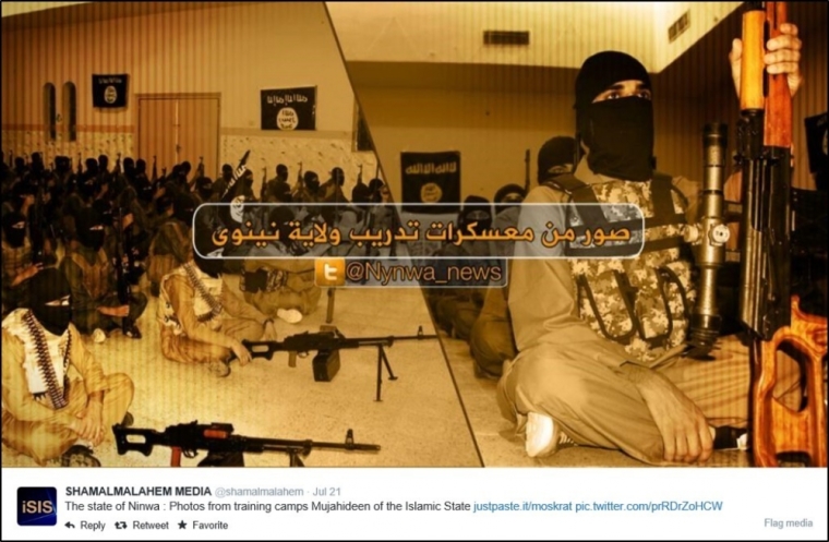
Participants of the Bellingcat report examined photos linked to Twitter by ISIS members from the site Justpaste.it that pictured numerous ISIS training activities.
The team was first able to put a finger on the region of Iraq the training grounds were in when they found a photo that was posted on July 21 of an assembly of ISIS members sitting inside their encampment in organized fashion with their assault rifles positioned in front of them. The caption in the photo reads "The state of Ninwa: Photos from training camps Mujahideen of Islamic State." Mujahideen is another muslim word for jihad, or struggle in the path of Allah.
Now knowing the training ground was in the Ninewa Province, the bloggers were able to analyze multiple photos where the troops were outside on the street noticeably near a river, which Bellingcat has deemed to be the Tigris River.
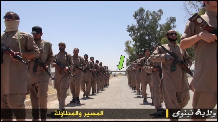
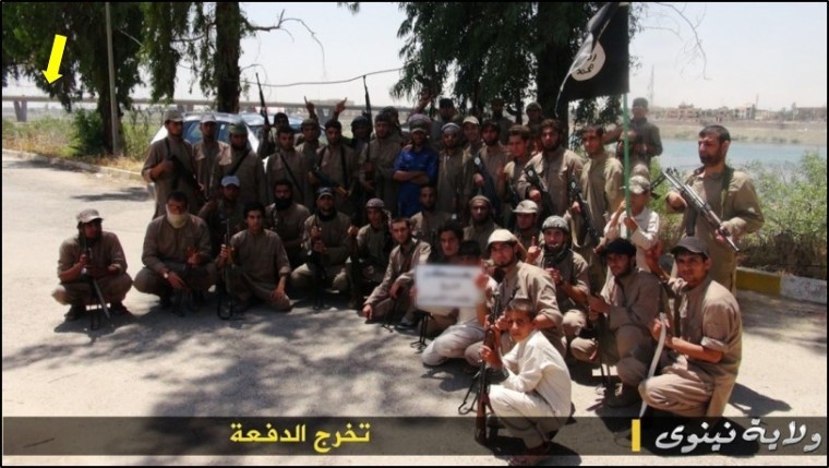
The team analyzed photos where the troops were marching, doing martial arts drills, and one photo that Bellingcat calls the "graduation photo," where members huddled around for one big group picture in front of the Tigris River.
The bloggers point out that in each of the outdoor photos, there appears to be a bridge in the background. In some of the photos, the bridge is easy to spot. In others, it takes quite the zoom-in to notice, but a bridge is, in fact, present in all of the photos.
What truly enabled the team to be confident in pinpointing the general area along the river, was specifically keying in on the graduation photo. They notice that in the distant background of the photo, there is a large, newly constructed building that protrudes above the bridgeline.

To further analyze this photo, they had to use a more updated imagery program than Google Earth called Flash Earth. When comparing this image's location on Google Earth – which is not well updated – to Flash Earth, with Google Earth there is a vacant lot where the building now stands on the east bank of the river. But on Flash Earth, the building is pictured. Using these programs, they determined that there is only one possible fit on the whole span of the Tigres river in Mosul.
"In the entire area there's only one possible location that matches, on the north side of the river, with the camera pointing south," the Bellingcat post stated. "It also appears the martial arts lessons were photographed in the same area, with the bridge running over the road visible, and the trees on the right"
The investigators found that the consistency in the placement of the bridge in the photos of the marches and martial arts drills help them further trust this geographical finding.
In order to confirm their theory, the team used a site called Panoramio which tags users photos on world map precisely where they are taken. Analyzing the terrorist photos posted on Twitter with the photos posted by the users of Panoramio of the same bridge in question, they were able to confirm that logos on the bridge and nearby landmarks in relation to the bridge are consistent between all photos.
The team also noticed that the street lights featured in the terrorist photos are consistent with the street lights in the Panoramio photos. Panoramio photos also confirmed a radio tower that was present in the marching photos.
Using the placement of the terrorists' series of photos in conjunction with the Panoramio photos, the team was also able to come to the conclusion that the photographed marched spanned 1.8 miles.